This walk will take you on an epic walking route starting at Casemates Square. You will see everything the rock and Nature Reserve has to offer, including spectacular views off the beaten path!
You will not find this level of information anywhere, not even in the official maps. In fact, the official map makes you climb the same section twice, which there’s no need for!
Things you will see on the Rock
- The Great Siege Tunnels
- Military Heritage centre
- Cable car station
- Skywalk
- O’Haras battery
- Spur battery
- Douglas lookout
- St Michaels Cave
- Charles V wall (500 years old and walkable)
- Apes den
- Devils gap battery
- Med steps (optional)
- Pillars of Hercules (optional)
WARNING: You need to be pretty fit to do this walk. I’m very fit and it still took me 4 hours (including stopping for pictures). The rock is 400m high and the roads are very steep so take a lot of water with you! If you fully explore every stop then it’ll be 6-8 hours long.
Note: If you’re on a cruise ship then just know it’s a 15 minute walk from the end of this guide back to the cruise terminal.
Gibraltar Rock Entry Fees
You will need to pay the £18 entry free to the Gibraltar Nature Reserve which can be done when you reach Moorish Castle. Alternatively, act like local and simply walk past the barrier and kiosk. They never ask for local ID (which makes it free) and just assume you’re supposed to be there. It helps to not look like an awestruck tourist though!
However you won’t be allowed to get into some places without a ticket.
Best Time to Climb the Rock of Gibraltar
The best time to walk the rock during summer is early morning. In fact the earlier the better as you’ll be walking on the Western face, which remains in the shade until about 10am. Alternatively set off at 6pm and be done by 10pm (before dark).
Pro tip: The views from the Rock are amazing, as you’d expect, but there’s one particularly amazing time to go up – when the Levanter Cloud appears.
The levanter cloud forms when easterly winds hit the Rock and condense to form cloud. See here for an example.
You’ll know this is happening as the northern part of Gib (airport area) will be cloud free but there will be cloud above Main Street.
On those days your views Westwards of the city will be extra dramatic with a layer of cloud just above your head. There will be no views East but you’ll get dramatic imagery of the cloud forming and streaming over the rock towards the city:
The Full Walking Tour with Pictures
1. Casemates to Entrance of the Rock
Casemates Square is the start of Main Street at the Northern end of Gib. Everyone knows where it is so if you need help just ask (Gibs are friendly!).
Start walking south down Main Street until you get to the first junction:
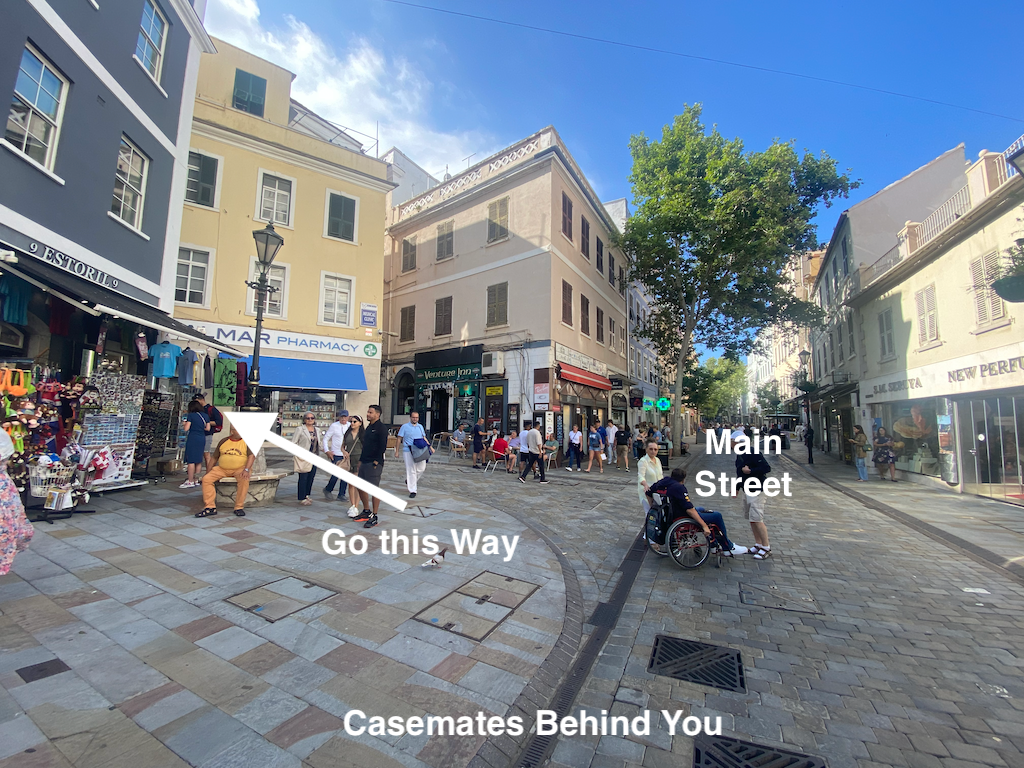
Proceed up that road until you reach a set of stairs on your right (Demaya’s ramp). Go up them:
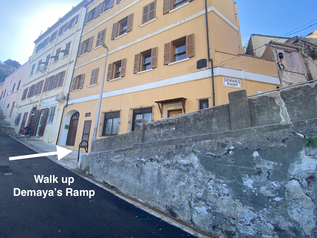
Stay on the right side of that set of stairs until you reach a junction at the top.
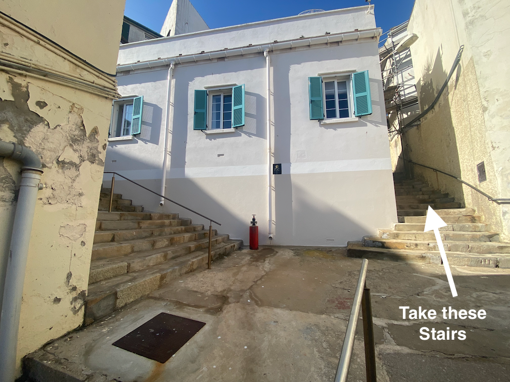
At the top of the stairs turn right. Follow the road/path keeping to the right. You will pas through a walkway with a large, old wall on your left and another walkway above you. Keep going until you reach the set of stairs pictured below (on your left). Walk up those stairs.
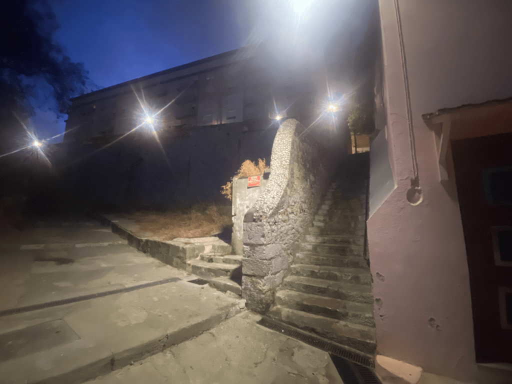
At the top of the stairs tun right:
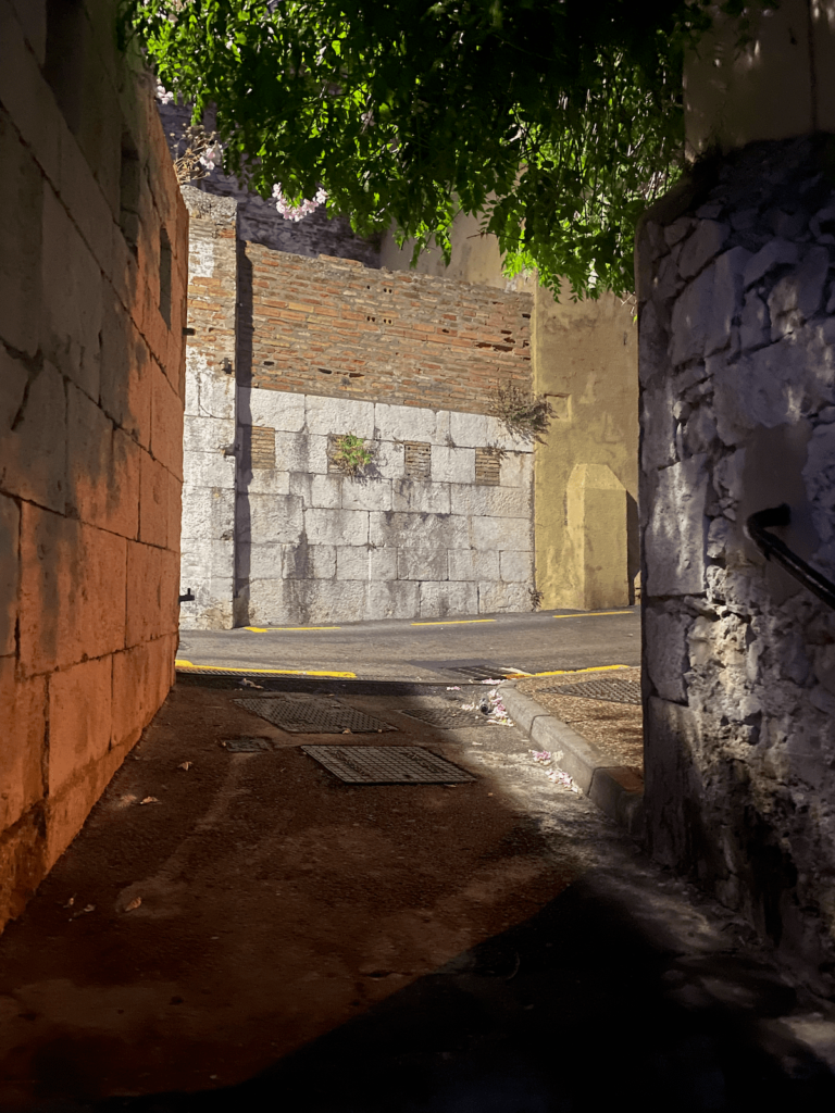
Walk until you see the following stairs on the left. Walk up them.
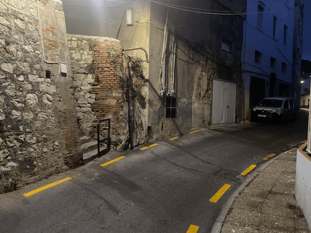
At the top of those stairs go straight ahead up the road (slightly to right in picture).
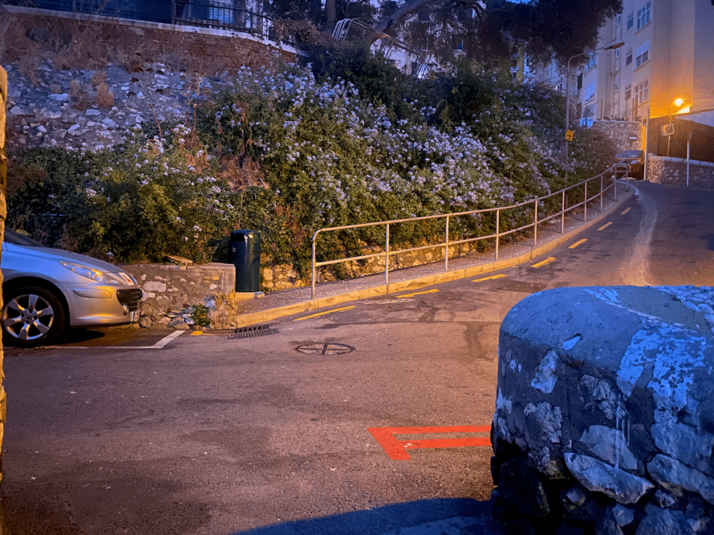
Once you get to Tarik Passage / Ramp turn right.
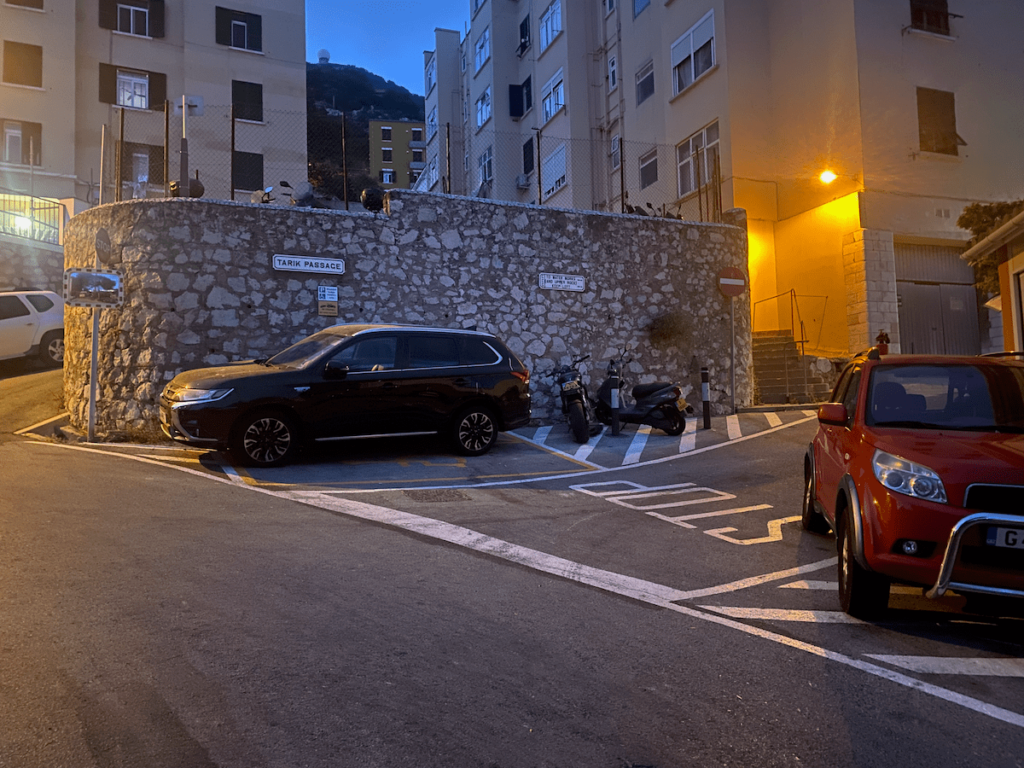
As you come around the corner on Tarik Ramp bear left up a very steep section.
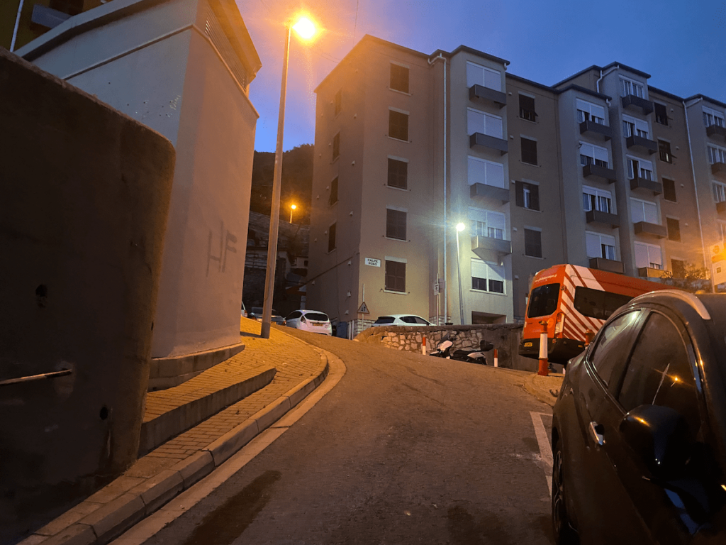
At the very top of that road turn left which is the road leading to the Rock Entrance. Follow the road and you will see the payment kiosk on your left. If you act like a local and just wave to the guy you can get past without paying, otherwise it’s £18 for a tourist ticket. You will need the ticket later on to access multiple attractions such as Great Siege tunnels, Skywalk, St Michaels cave etc. They usually have a guard posted on each.
However if you set off at 6/7am then no ticket is necessary but some places will be closed!
2. Northern Rock to Signal Station Road
Once you’re through the entrance you’ll be faced with Moorish castle. Feel free to stop and explore here (or anywhere along the way). Moorish castle is very old, built around 711 AD. It’s also where Gibraltar prison was until 2010!
FYI: The main tower is called The Tower of Homage and it’s that you see prominently from everywhere in Gib.
Once you’re done with Moorish you can also check out the World War 2 tunnels.
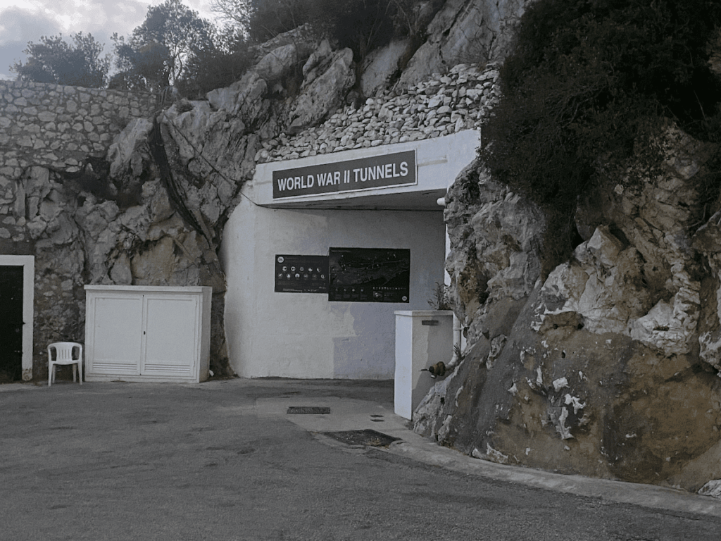
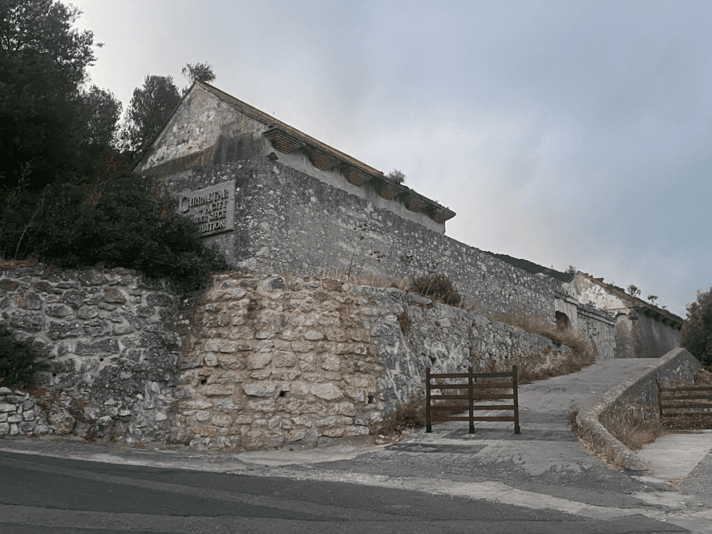
Following that proceed south, up the road. When you get to the first hairpin you will see the City Under Siege exhibition.
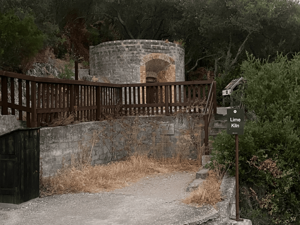
Stop here or proceed around the hairpin, heading back north (and uphill). The Lime Kiln will be on your right. This traditionally produced lime for agriculture and building materials. Occasionally the lime was used for efficient disposal of bodies in medieval times! The kiln is no longer in use, you’ll be glad to hear!
Follow this road up to another hairpin, which presents you with the Military Heritage Centre and Willis’s Guard Room. There are some great views from here!
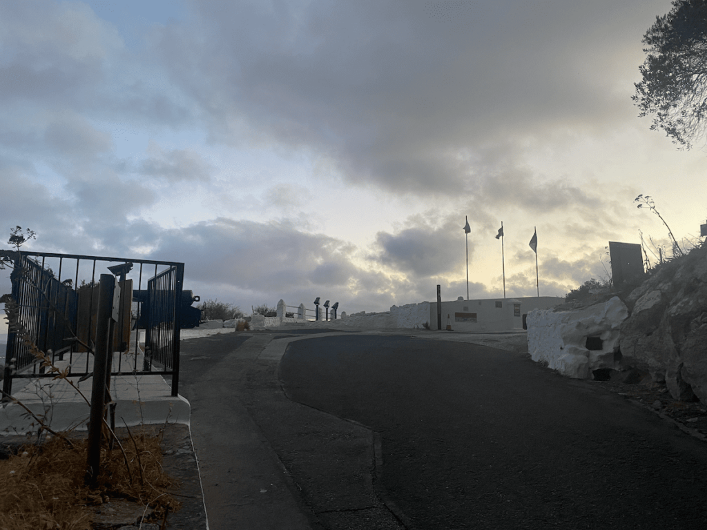
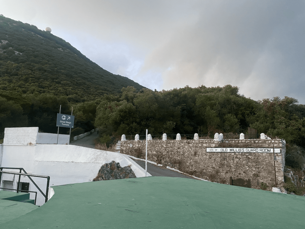
There are 3 side routes you can take from the point in the image above. Starting from left side:
- Willis’s road leading to Princes Annes and Amelias batteries
- Farrington Road leading to Farringdon Battery
- Upper Galleries leading to the Great Siege tunnels (sign posted in image)
All 3 routes are dead ends (unless you like cliff jumping) so when you’re done head back to the junction in the image. Once you’re back continue on the winding road with the Military Heritage Center to your back. Walk uphill along Queens Road (might also be sign posted as Signal Station Road).
You will reach a 3 way fork in the road – take the left fork which is Signal Station Road. Prepare yourself for what feels like the world’s longest and steepest hill.
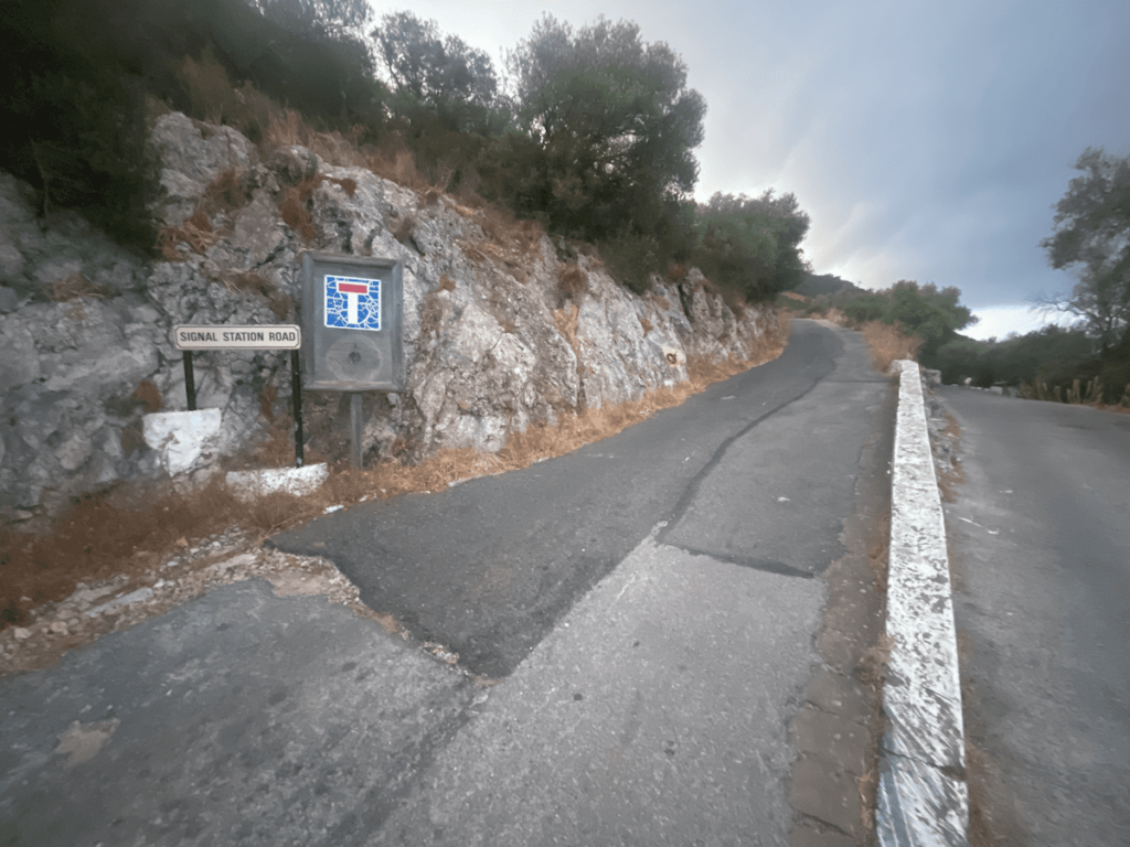
After a couple minutes you’ll hit another junction. Do not take the first left, but do take the second one which is a dirt path, leading up to a rejuvenated area with decent views. Note that it will be closed if you’re an early morning walker.
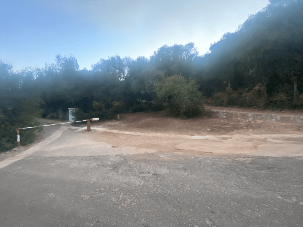
Once you’re done with the view then come back to the junction and walk up the road a little further and take the next left:
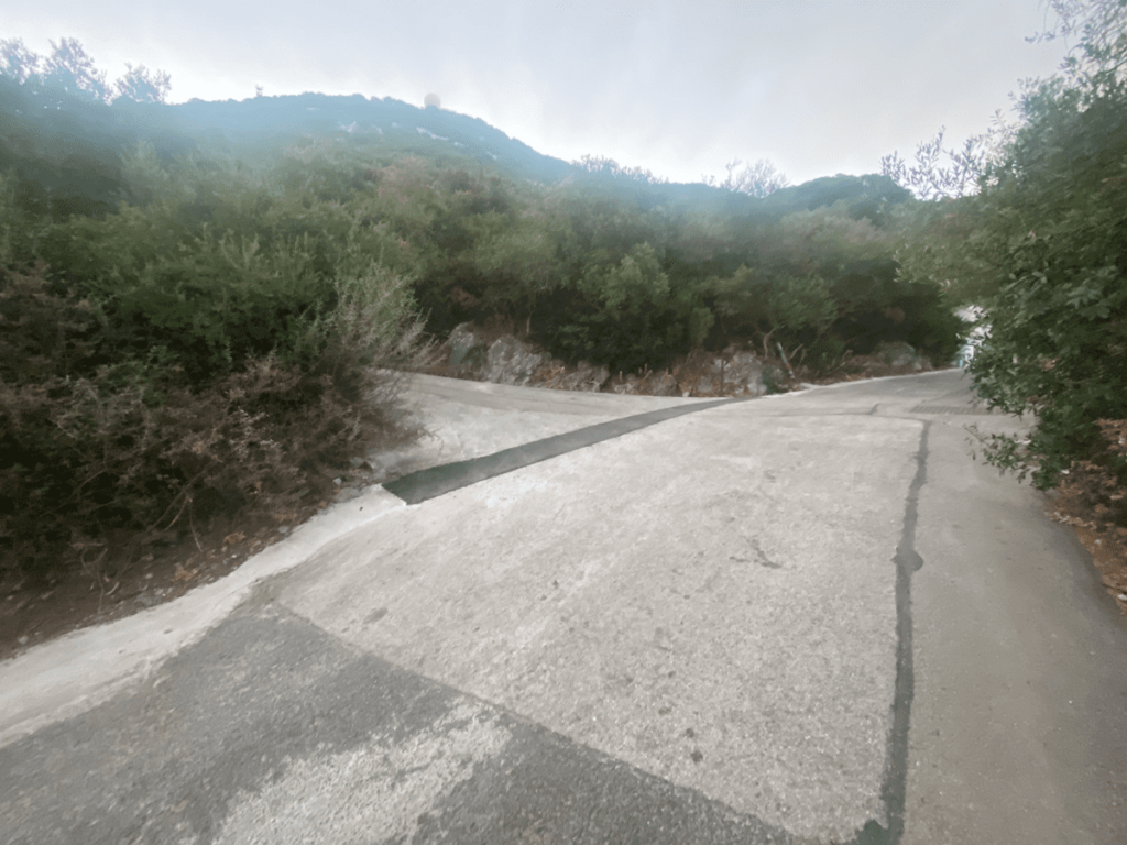
Now follow this road (Signal Station Road). There are some great, unobstructed views along here so take plenty of photos!
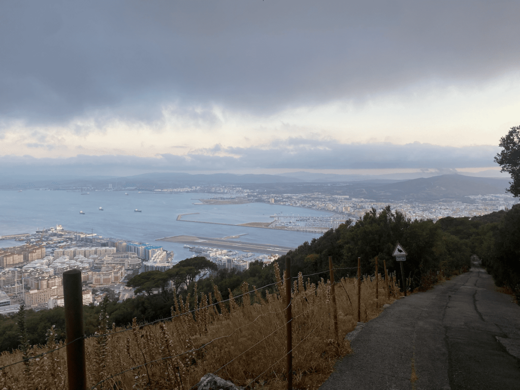
3. Signal Station Road to The Cable Car Top Station and Signal Hill
Continuing on Signal Station Road you will reach a junction that has one road leading sharp left up the rock. That road is forbidden to enter as it contains the RAF radar station at the top of the rock :(. Continue up Signal Station Road.
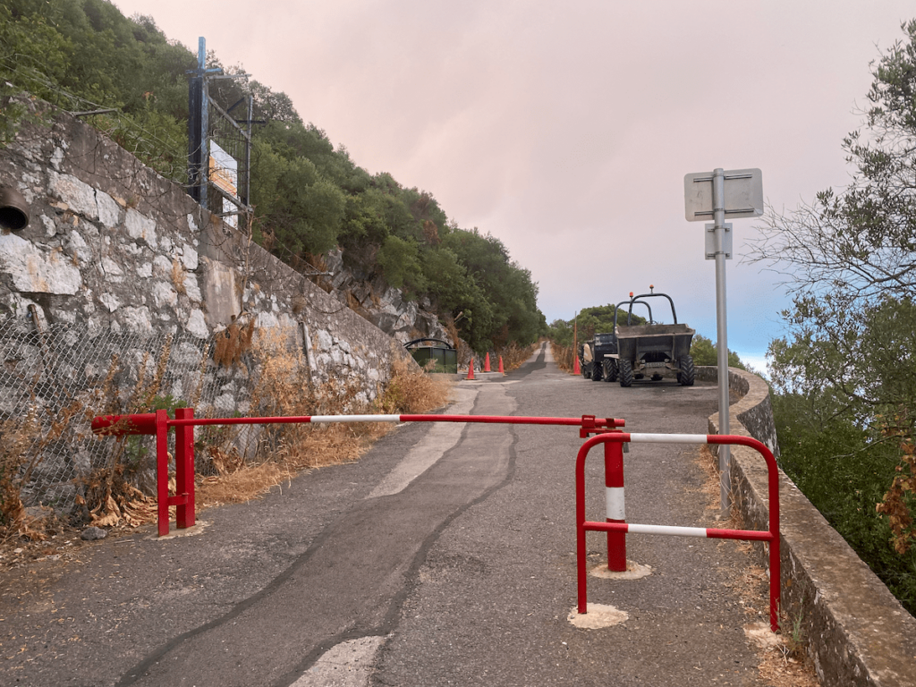
You will reach another junction with one road leading down and the other up. Your poor legs will really, really want the down – but you must go leftwards, and up!
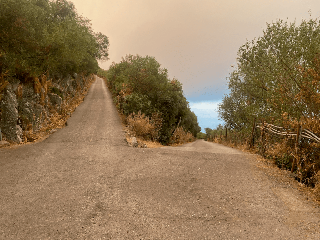
Proceed on the left side walking up the hairpin bends. You should be able to see the top cable car station now.
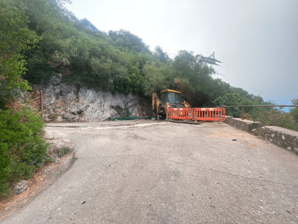
Follow the road all the way around until you reach the road under the cable car station. Keep walking under and away from the cable car station until you reach a left hand sharp turning (end of image below). This will take you up to the station.
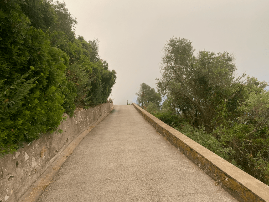
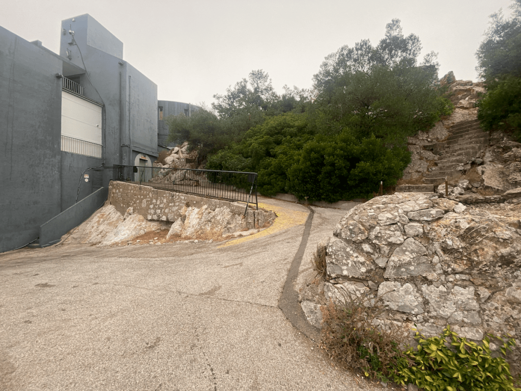
It’s time to enjoy some EPIC views up here! Ignore the station and walk up the steps on the right of image above. You can also expect to see many Macaques up here!

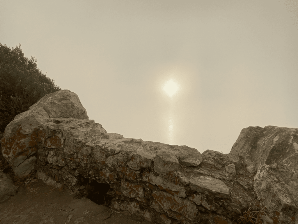
Once you’ve finished looking around the cable car station and Signal Hill go back down the road you came up until you reach the junction. Walk south to the Skywalk.
4. Cable Car Top Station to Douglas Path and Douglas Lookout (Best Monkey Pictures)
Walk South on St Michael Road with the cable car station behind you. The Skywalk is just up ahead.
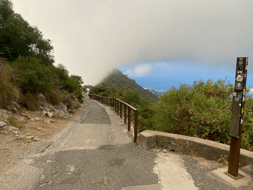
You will pass the Macaque feeding station here. Please don’t feed them your food, or you’ll be fined £250! You’ll also make them more food aggressive, where they will jump on children’s backpacks searching for food.
You will also pass a very old wall running vertically up the Rock called Charles V wall, built to keep Barbary raiders out.
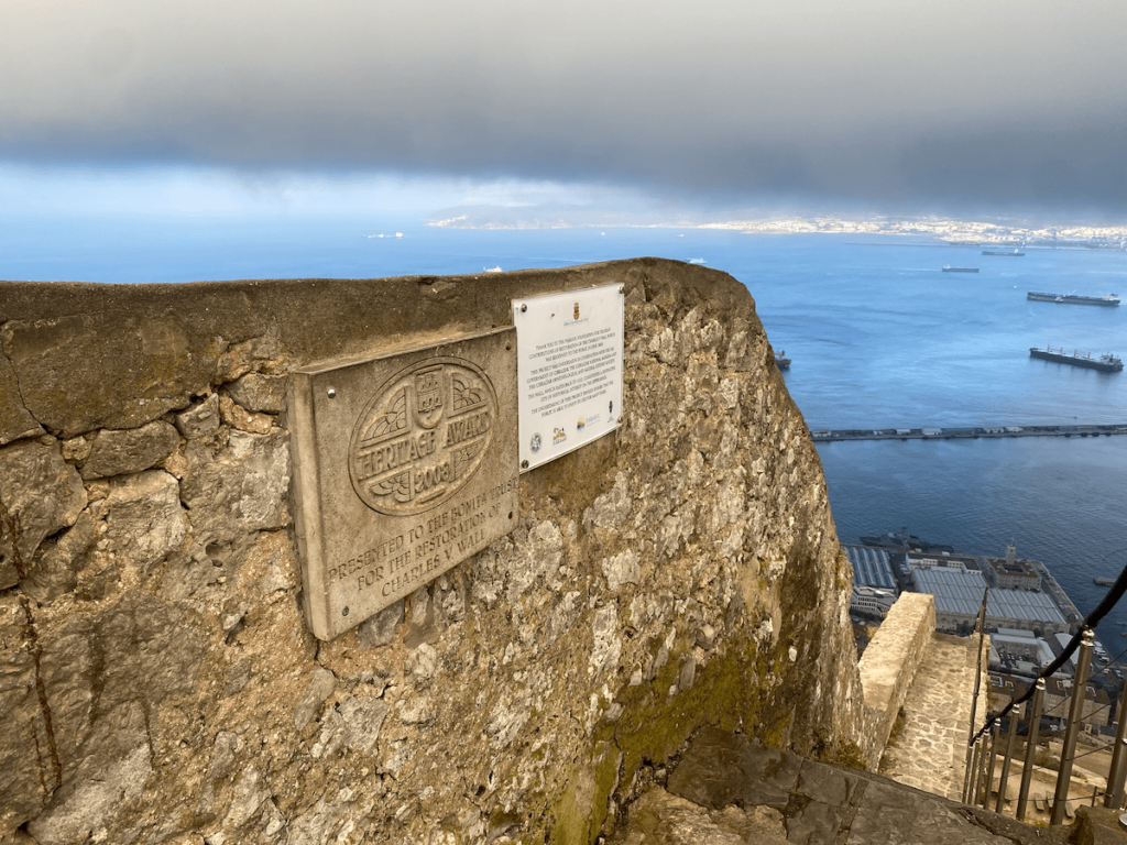
You can use this wall to descend or ascend the Rock freely but there may be Macaques blocking your path on the way. You can bang 2 rocks together to shoo them off the steps but do not get too close if they don’t – they are wild animals.
If one makes a pouty face at you then it’s not being cute, it’s a warning to back up!
We will come across this wall later in the tour so no need to go down it now.
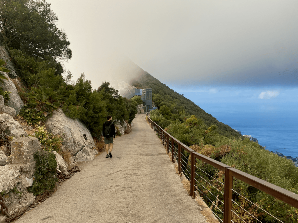
If it’s before 9am the Skywalk ahead will be “closed”, however there’s a lift that should still work to take you up to the actual skywalk. A Spanish worker might be around if it’s after 8am and tell you it’s not open yet, but you can probably slip past before he sees you. The views are awesome but vertigo inducing.
At the top of the Skywalk lift (right side as you came in) there’s a path leading up some steps to the right. This is the Douglas trail and lookout which will probably be closed if it’s before 9am. HOWEVER the trail is very much open if you approach it from the other side, which we will now do.
The Douglas Lookout is (in my opinion) the best place to get the best monkey pictures in all of Gibraltar! Evidence below:
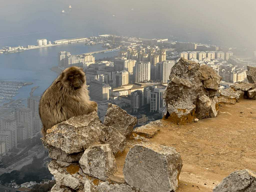
As you walk away from the Skywalk area on St Michael Road you’ll come to a junction. Take the left side, south and uphill:
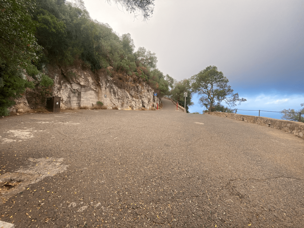
You’ll reach another junction. To your left is Douglas Cave (which might be open) and to your sharp left is the Douglas Path and Lookout. Walk along Douglas Path for those epic Macaque views!
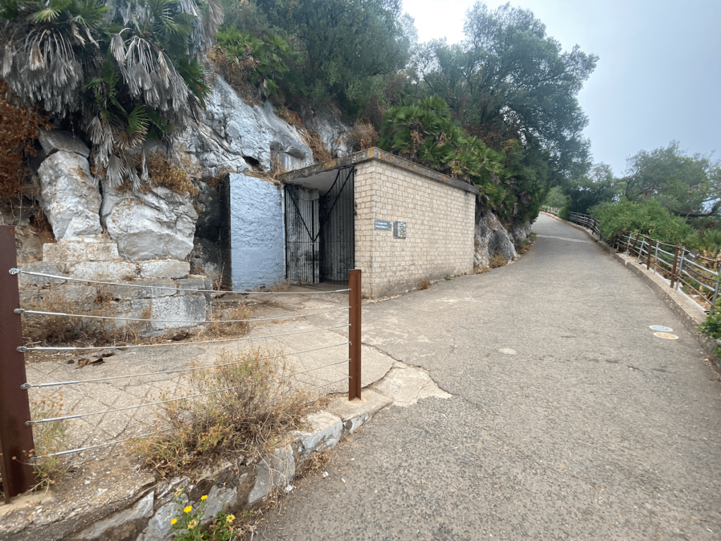
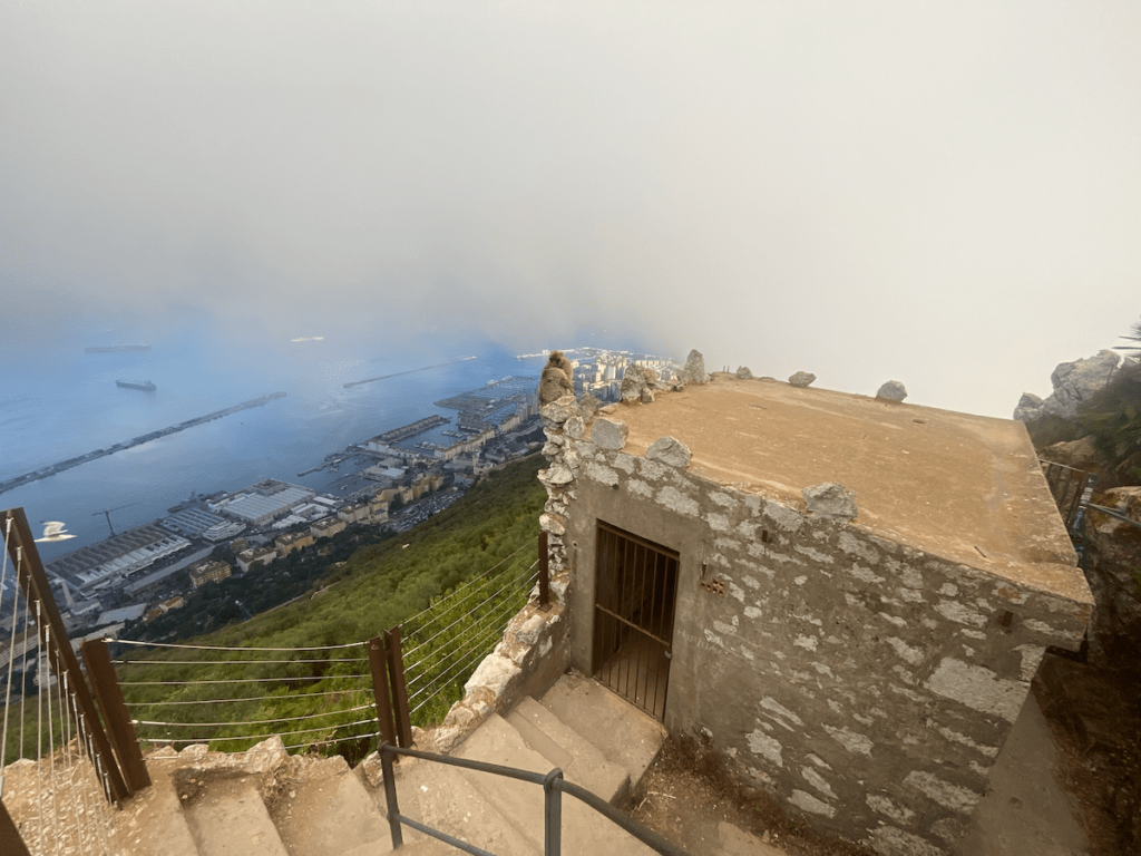
Once you’ve filled your photo roll head back south to the junction that brought you onto the Douglas Trail.
5. St Douglas Path / O’Haras Battery / St Michaels Cave
The next stop is O’Haras Battery. Note that it only opens at 9.30am!
Back at the junction (with Douglas Path to your left) walk south toward O’Haras battery. You can also access the Med Steps this way but we’re not including that in this guide as it takes you away from the other sights on the west side of the rock.

Once you’re done exploring O’Hara’s battery then turn back and walk back down the road.
Walk past the Douglas path turn off until you reach the next junction. Turn sharp left here and walk down the hill to St Michaels cave.
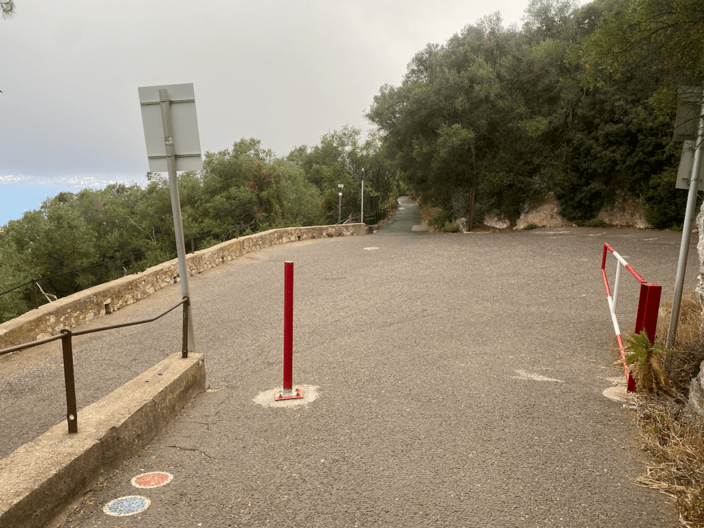
At the bottom of that road there’s a cafe if you need refreshment and of course St Michaels Cave. Definitely worth having an explore around!
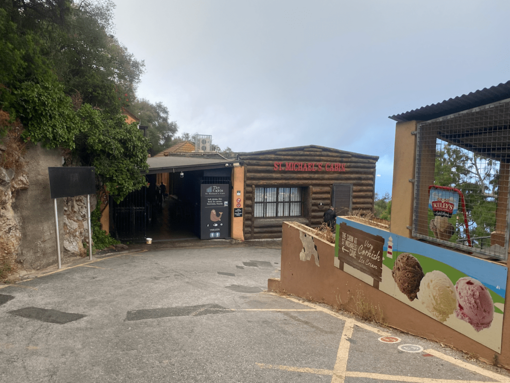
Once you’re done with St Michaels cave there are couple of exit points. If you come out at the image above then follow the instructions below. Otherwise if you come out on Spur Battery road then simply turn left and walk uphill.
7. Spur Battery / Apes Den / Windsor Bridge
Spur Battery is optional as it’s the hardest hill to climb of them all! However it gives good views over the South District and Morocco. As mentioned earlier you will come out of St Michaels Cave at either St Michaels cabin or at the lower level on Spur Battery road.
The following instructions take you from the cabin to Spur Battery road.
Walk downhill around the St Michaels hairpin until you reach a junction. Take a sharp left to get onto Spur Battery road.
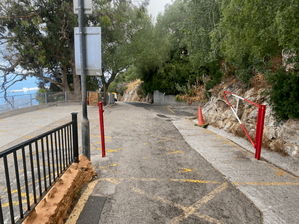
Enjoy your arduous walk up the top! Once there you’ll need to do a little climbing to get the views. Be careful as there are no safety barriers! However, if you fall 200m at least there’s the Royal Naval Hospital right next to you!
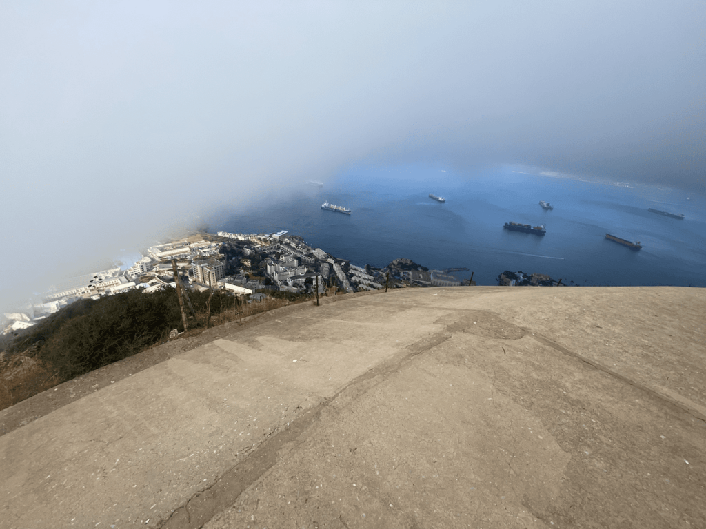
Once you’re done cooling off in the wind (south Gib is very windy) head back down Spur Battery Road. When you get back to the junction in the image below walk along the road straight ahead.
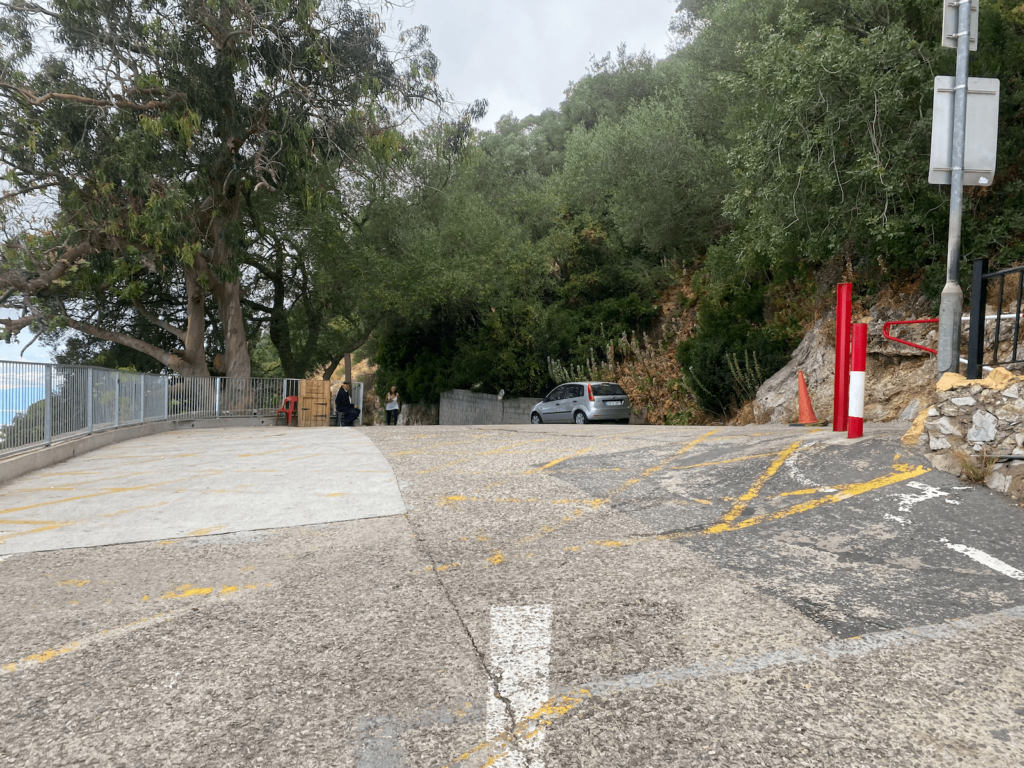
We are now on the way to Apes Den, Charles V Wall and Windsor suspension bridge. Follow the road down, optionally stopping at the Queens Balcony pictured. It was so named because the Queen once stopped there…
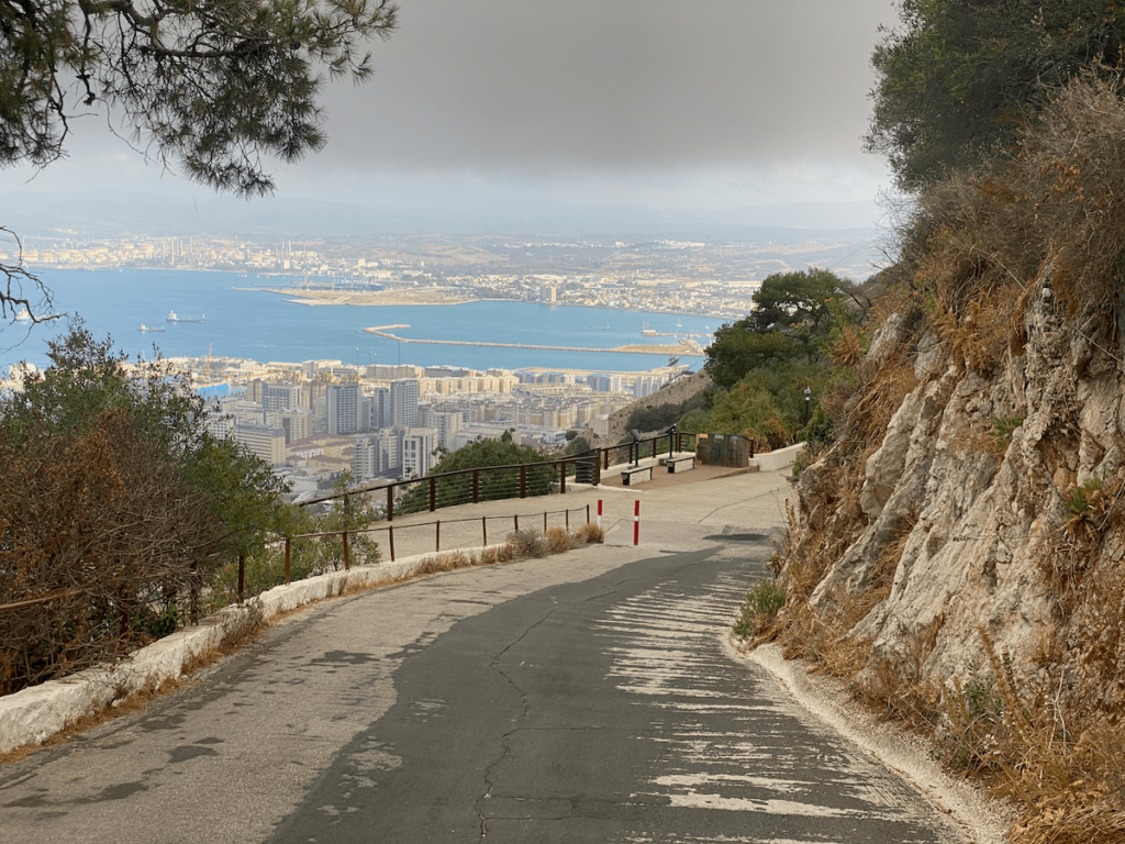
You will then reach a 3 way fork.
- Left fork takes you direct to Apes Den and Windsor bridge
- Middle and right connect to where you started this adventure
All options intersect Charles V wall which can be used to ascend or descend to any of the forked roads (or even the Skywalk!). HOWEVER you may encounter monkeys that will not move out of your way when climbing the steps! If that’s an issue then please take the left fork. In the guide below I take the middle fork then walk down Charles V wall to the apes den.
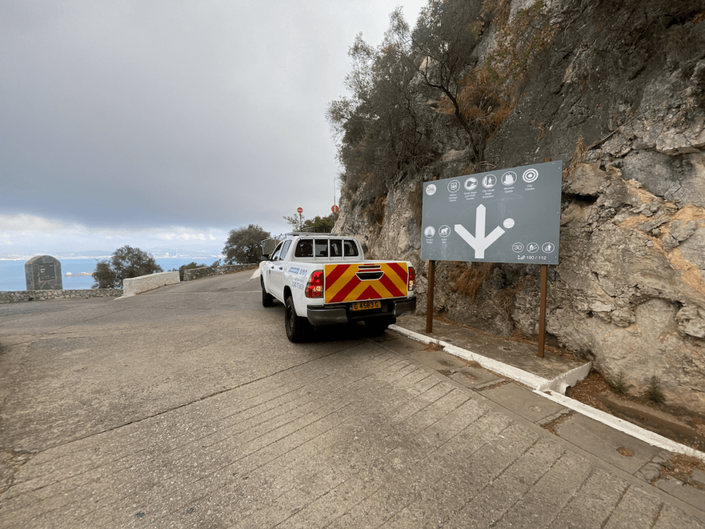
Taking the middle option brings you to Charles V wall. Admire the views and then walk down the wall to the apes den.
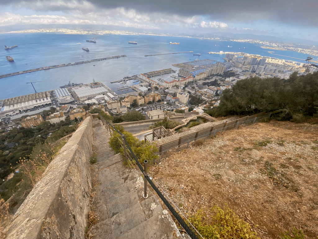

At the bottom of Charles V wall you will be where the left most fork would have taken you, the Queens Gate. Now, if you want to walk across the Windsor bridge you will have to turn left and walk back up slightly. Alternatively if you took the left fork then look out for the Windsor bridge turn off on the left before you reach Queens gate.
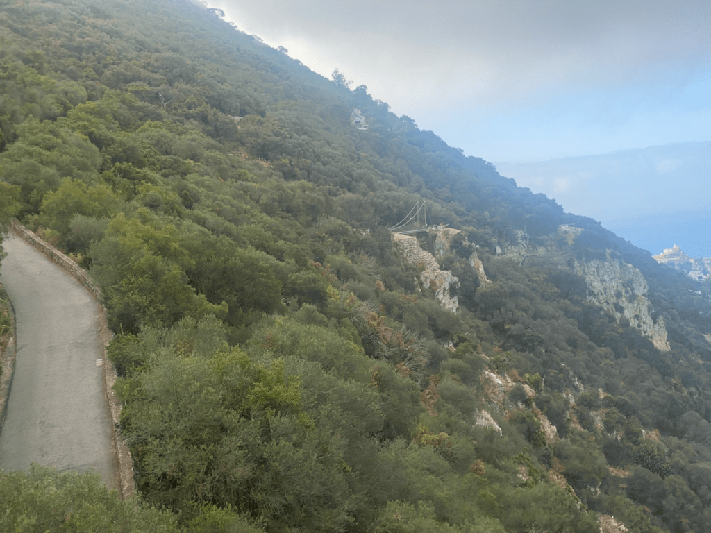
Once you’ve done the bridge head back to the left most fork road and Queens gate. Walk downhill from there, optionally stopping at Prince Ferdinands battery (surely you must be tired of batteries at this point??!?).
Keep walking down until you reach a fork. Go left and you will pass the ticket office, just after which is a hairpin bend you should follow around.
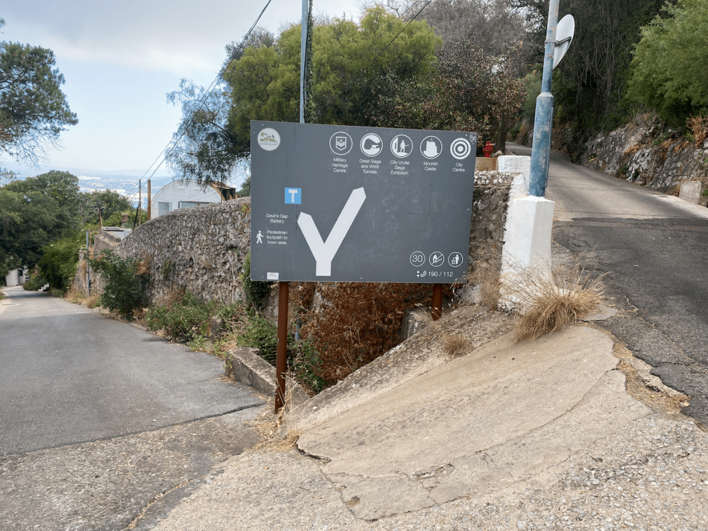
8. Exiting the Rock via Devils Gap / Battery / Path into Upper Town
Once around the hairpin bend you will encounter Devils Gap Battery on the right. Feel free to explore! This battery is famous for having sunk a German U-boat in World War 1 that was running on the surface across the bay. The guns had a range of 5.5km so could easily control the whole bay of Gibraltar.
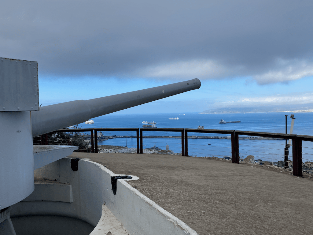
Once you’re done, proceed down the road until you reach the Devils Gap footpath on the right. This used to be a road in the old days up which cannon were hauled. Try to spot the rings embedded in the rock that aided in dragging them up.
Walk down the path until you reach upper town. There’s one more sight to see, which proves why Gibs will get very angry if you call them Spanish.
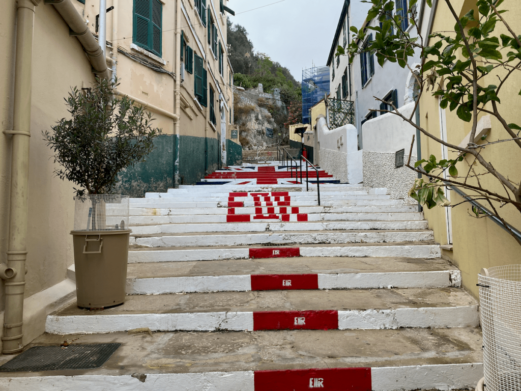
After the 1967 referendum a new constitution was passed in 1969 to reflect their independence and alliance with Britain. Shortly after that the Spanish government threw a hissy fit and closed the border until 1985!
However entitled the Spaniards think they are to Gibraltar, they are not. They legally signed it away in the treaty of Utrecht.
And that concludes the full walking tour of the Rock!
Did You Enjoy?
I hope you enjoyed this mammoth walk / climb. Is there anything that you found confusing about the guide? If so then please let me know via the contact page.
